Barbee Mill
Infrastructure & Sediment Survey
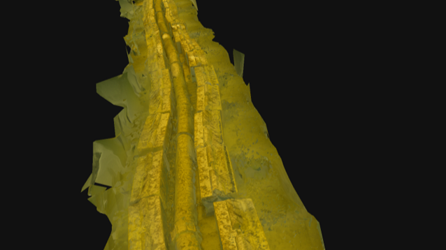
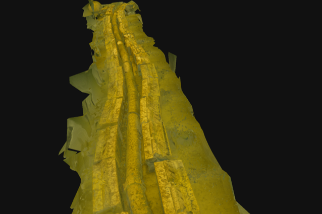
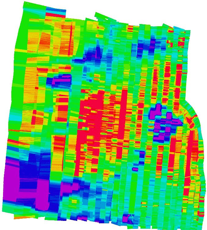
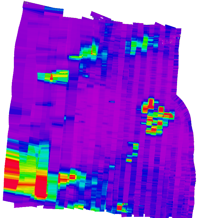
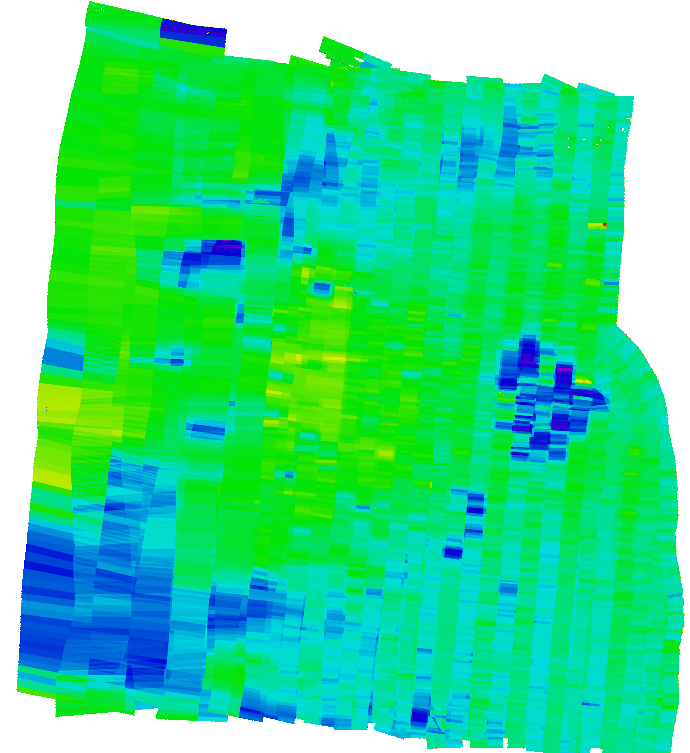
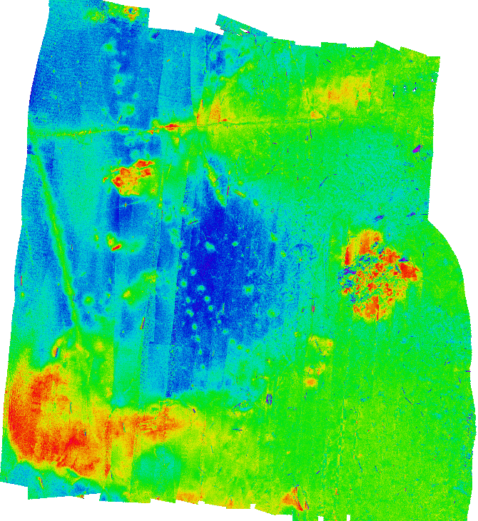
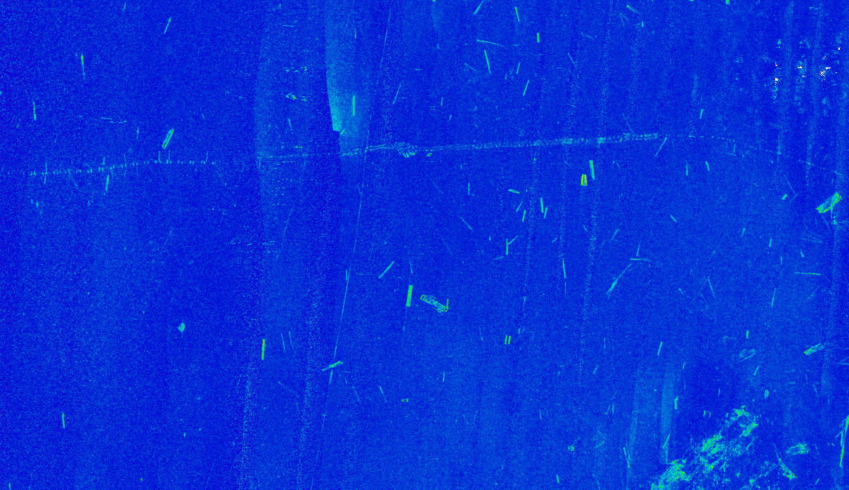
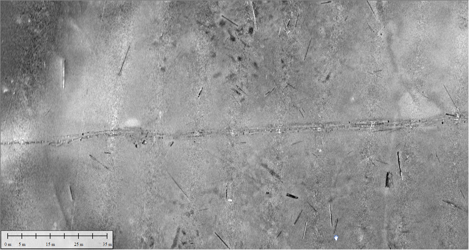
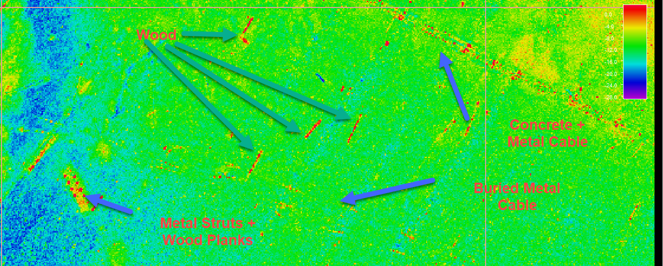
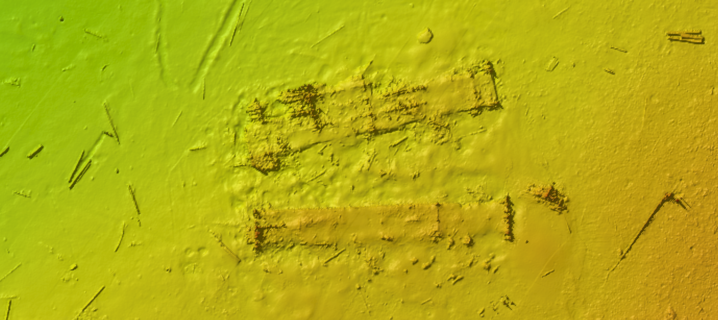
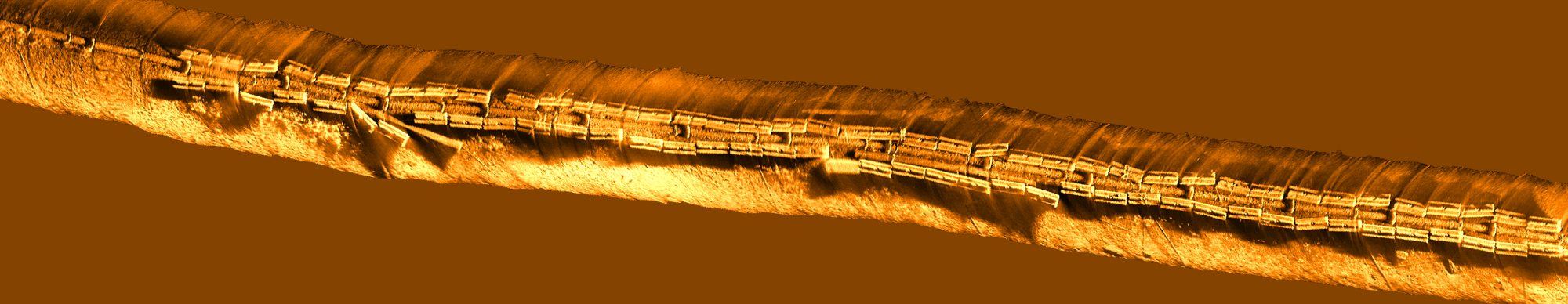
Coastal Sensing & Survey was tasked with a multidisciplinary survey at the decommissioned Barbee Mill Superfund site on the eastern side of Lake Washington. Known for its dense debris and pilings from the old mill, the site presents significant debris challenges in addition to contaminated sediments. Additionally, more than a hundred years of industrial activity at the site presents multiple sediment types within the area. CSAS was engaged to create a detailed hazard map, characterize vegetation boundaries and hazards by type, and use calibrated beam backscatter to conduct statistical sediment analysis and angle range analysis (ARA) for comprehensive site sediment characterization.
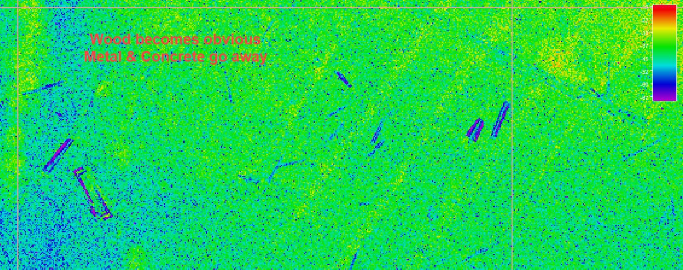
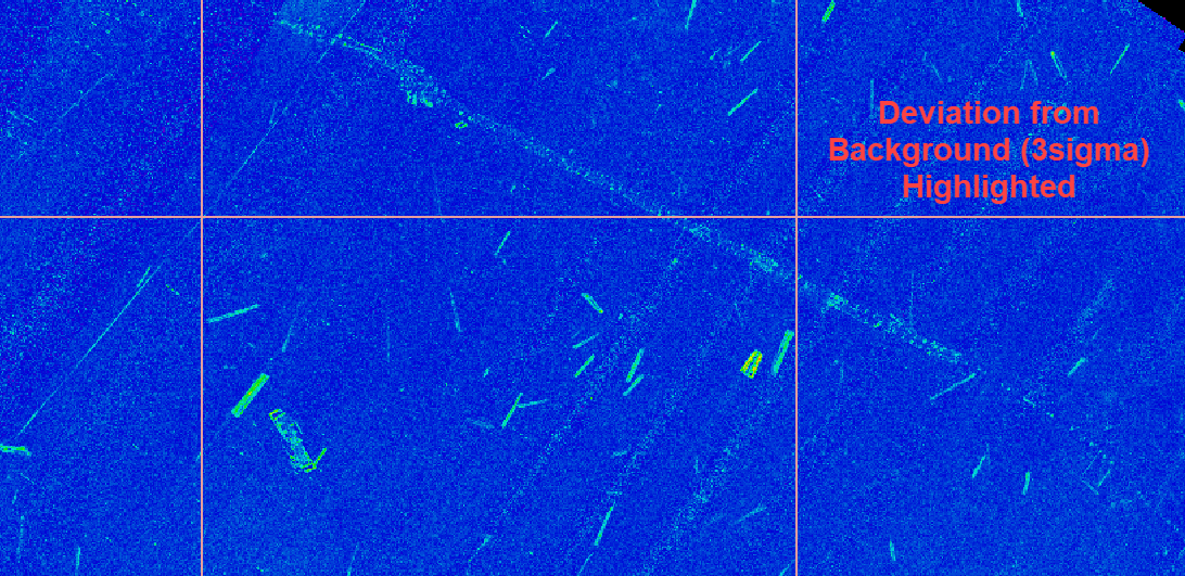
Using our multi-sensor approach we were able to create a comprehensive site sediment and differentiation map which aided in cable & debris identification. Using BSO Statistical Intensity analysis allowed for detailed material difference discrimination. Ultimately we were able to provide the client with elevated debris maps, cable routes both above and below sediment, sediment classifications, and surface analysis maps.
More than a century of industrial activity left behind a complex underwater landscape. By differentiating sediment types and documenting debris distribution, this survey established a detailed baseline that can guide ongoing remediation and monitoring efforts. Clear documentation today supports accountability and environmental recovery over time.
What capabilities we used: Forward looking sonar (FLS), Sidescan, ROVs, Bathymetry, Backscatter & ARA, and Photogrammetry.