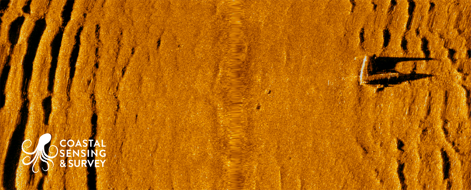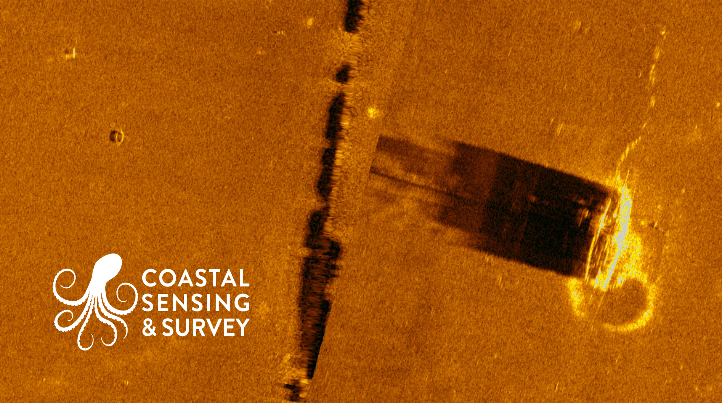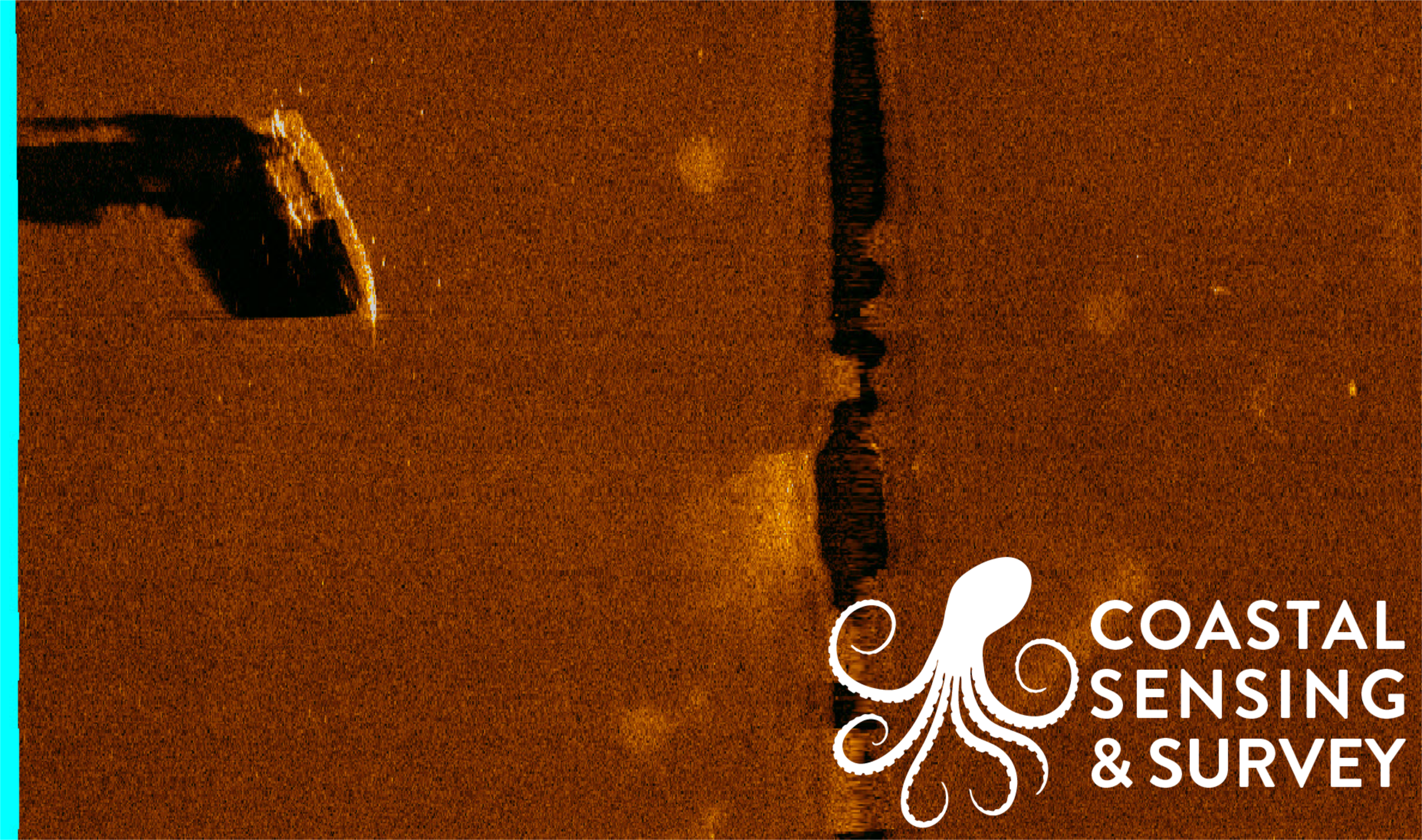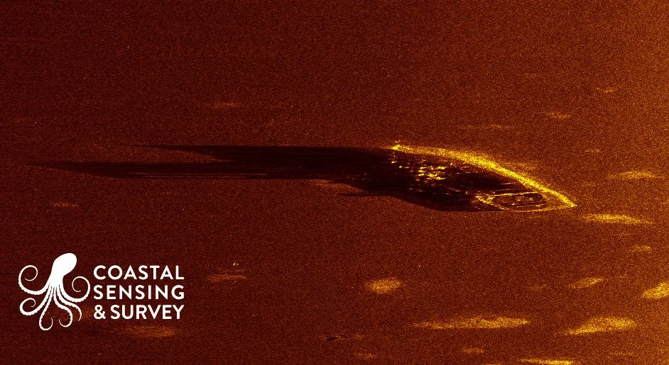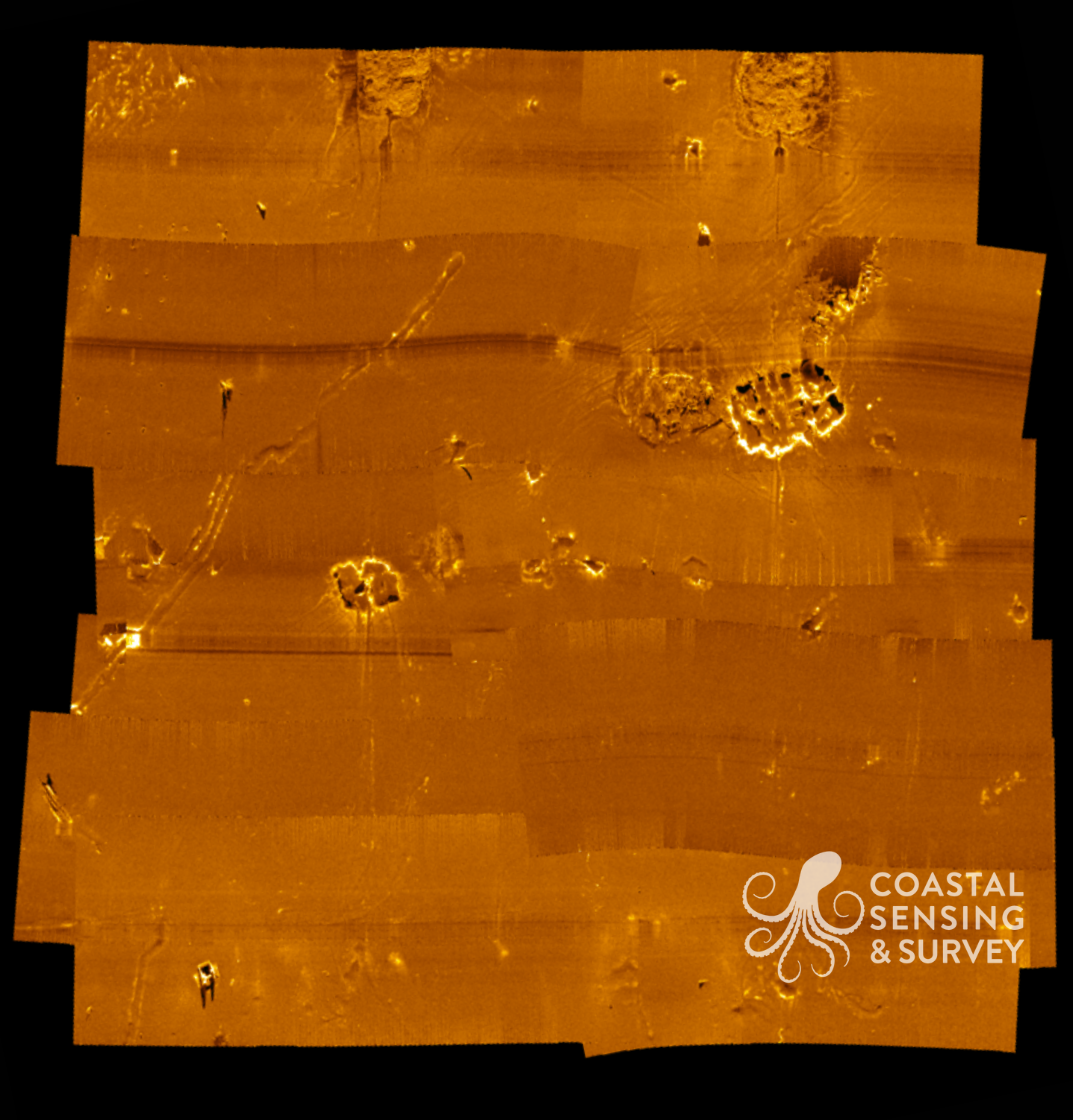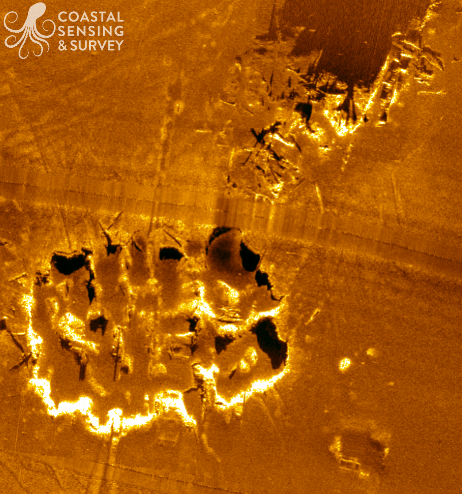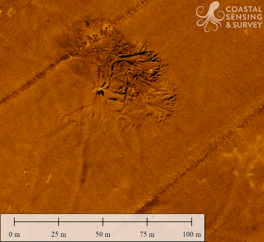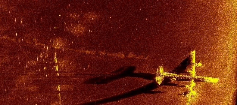
Sidescan
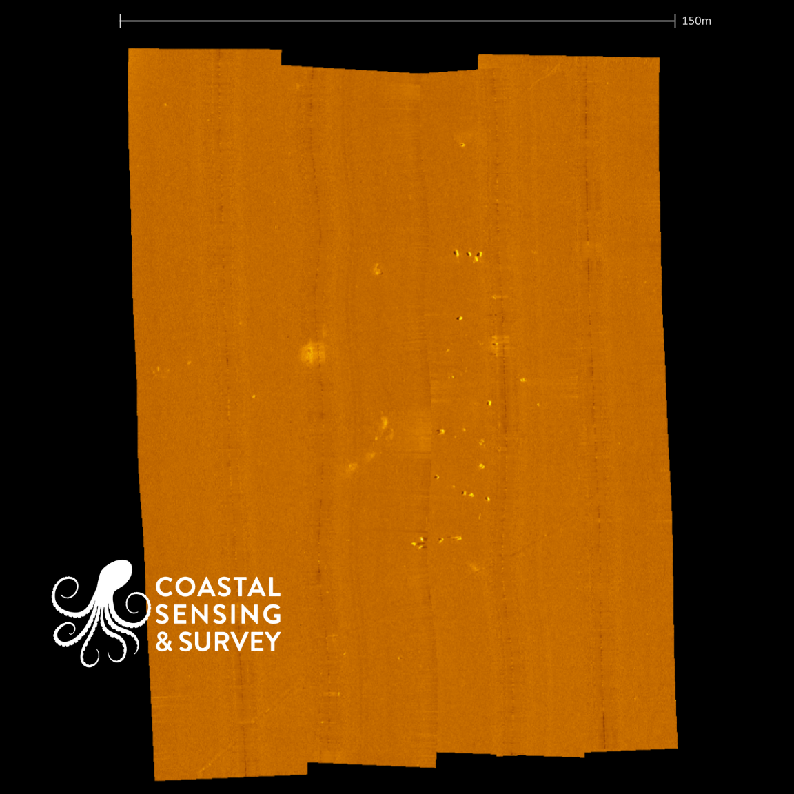
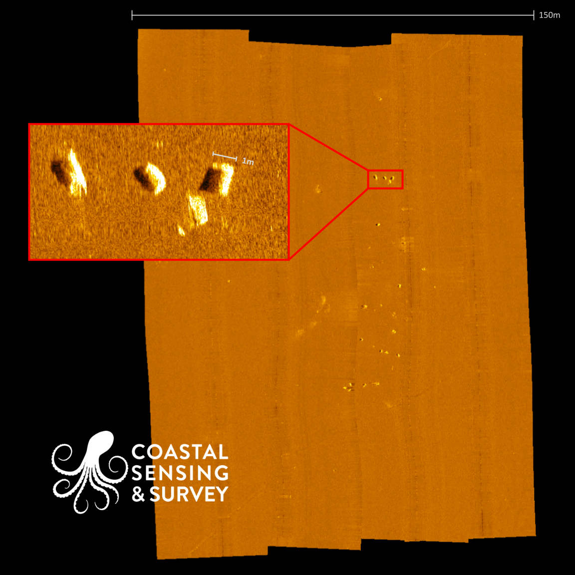
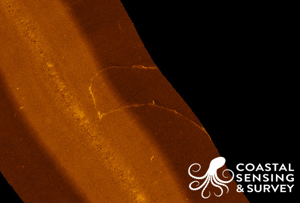
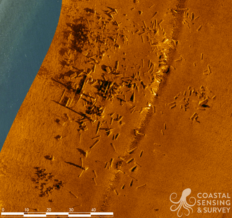
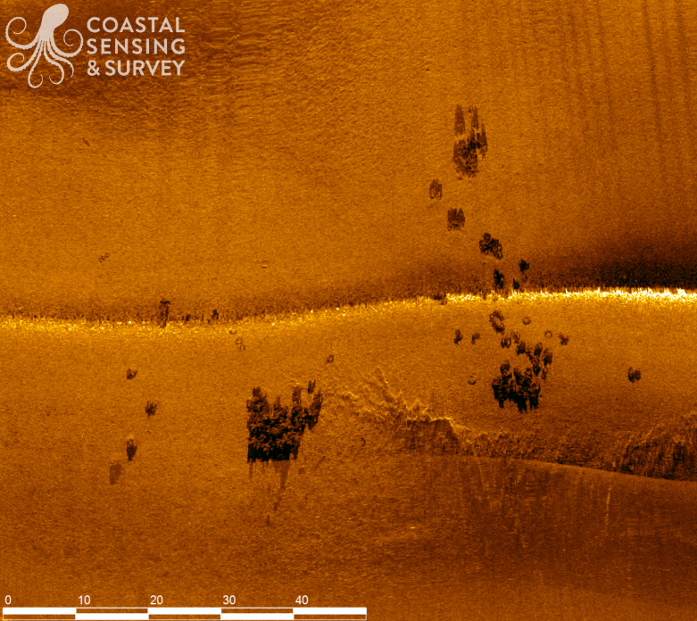
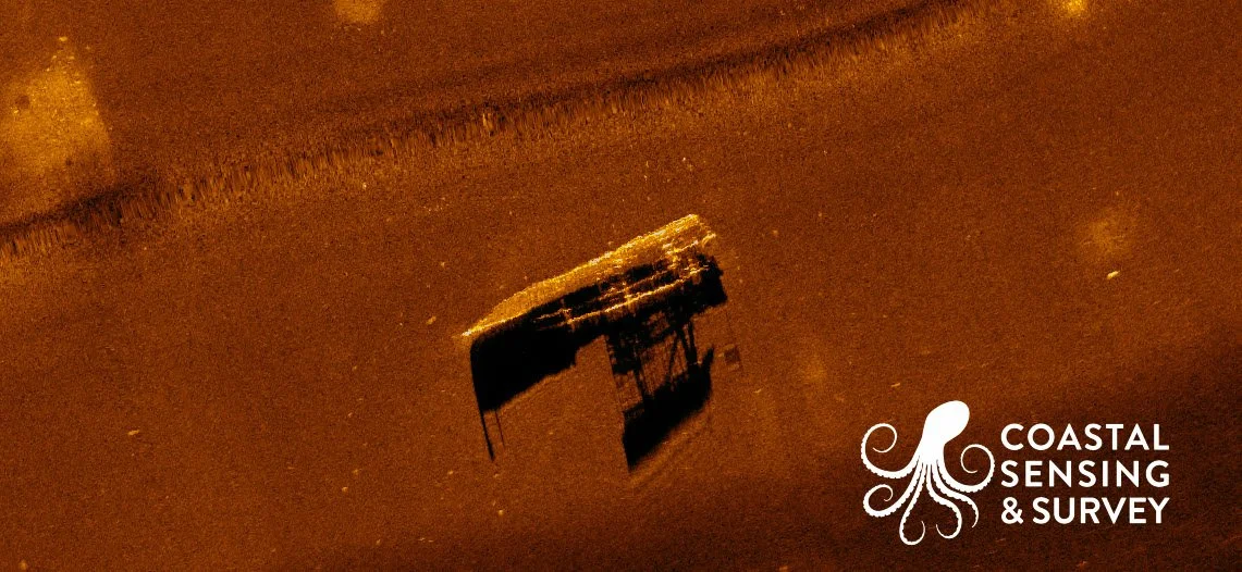
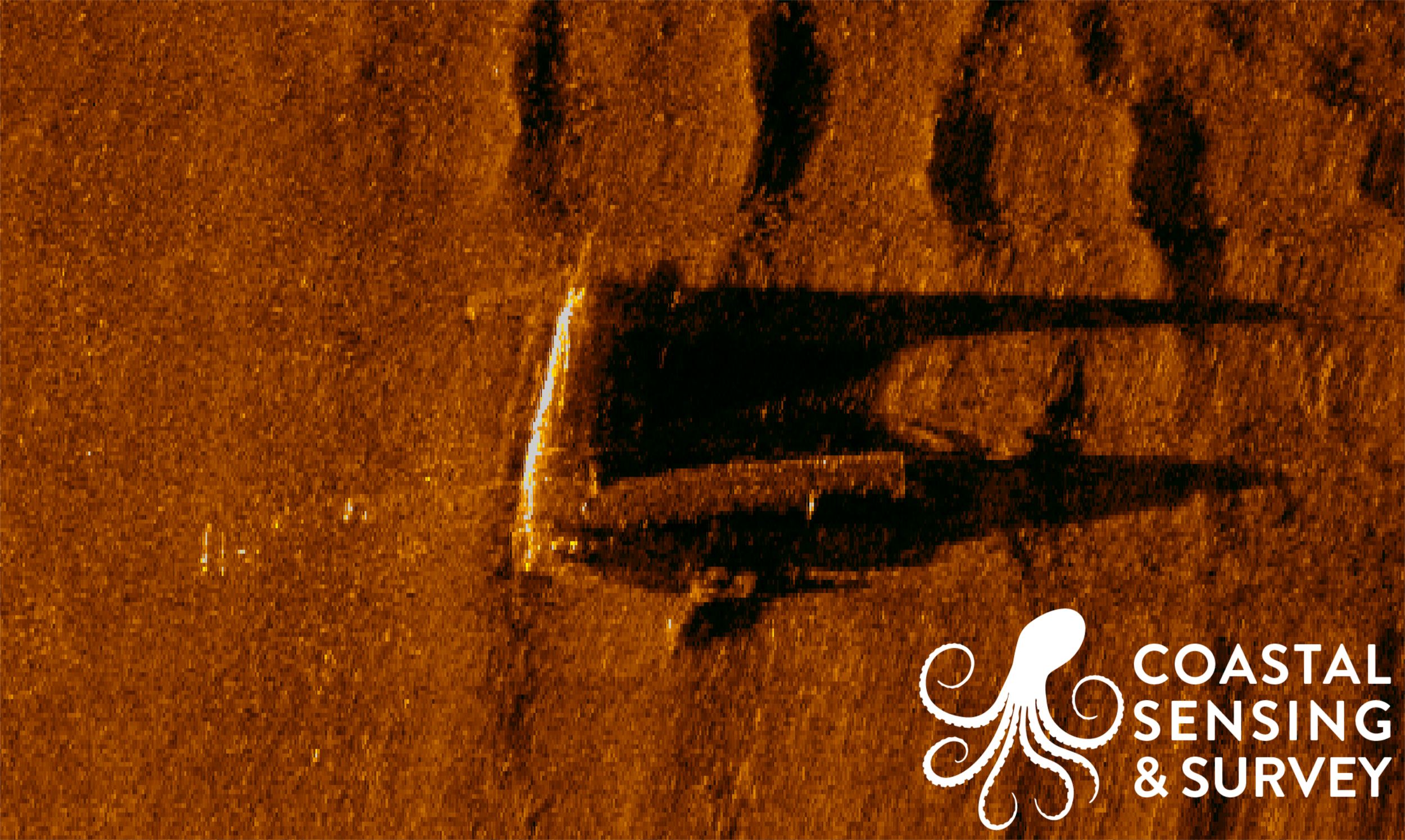
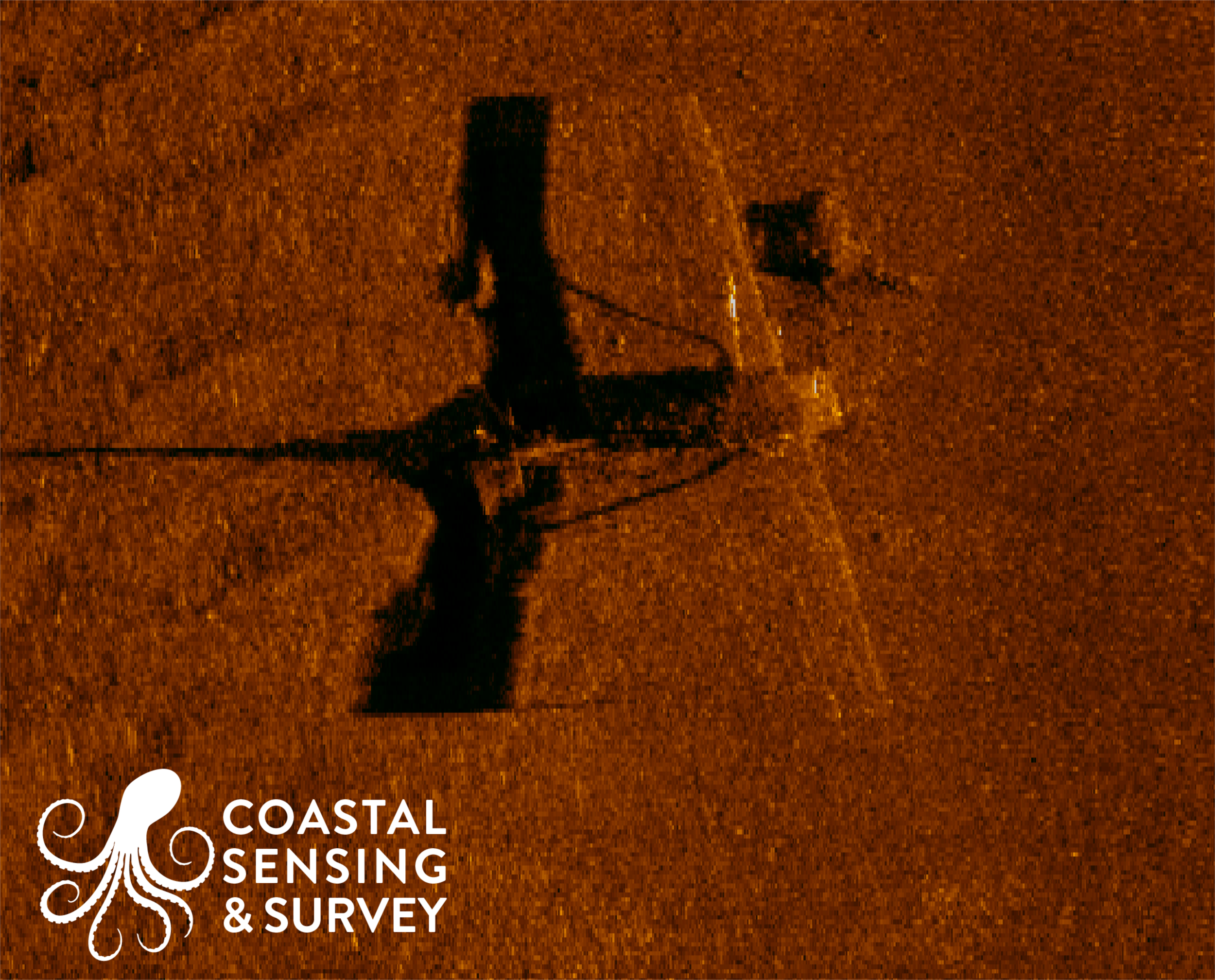
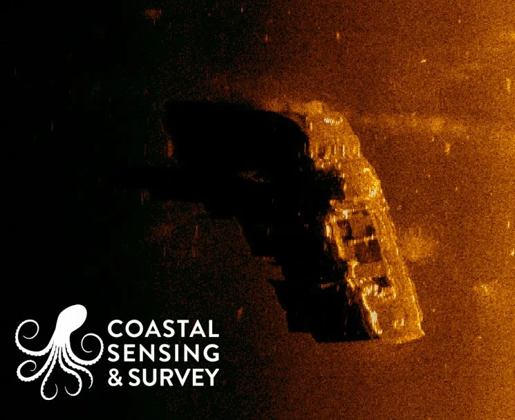
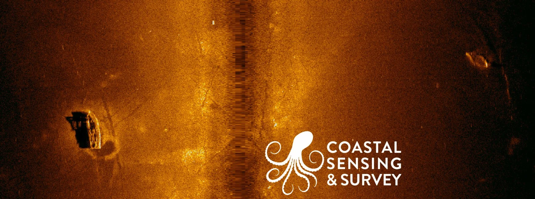
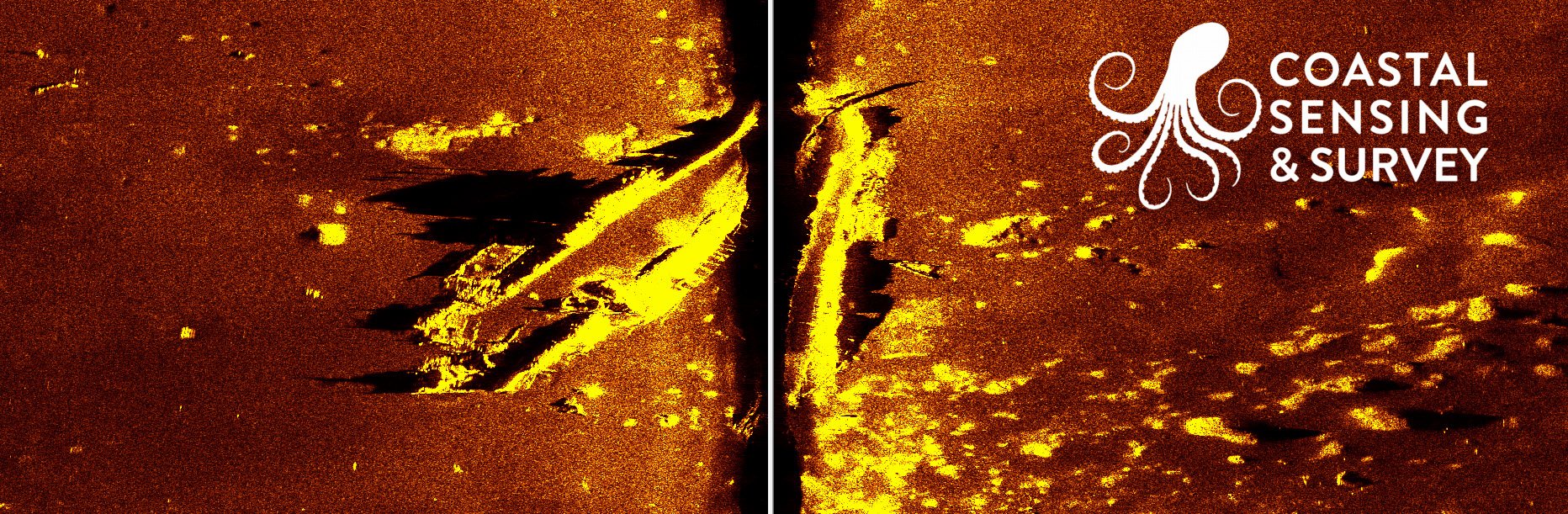
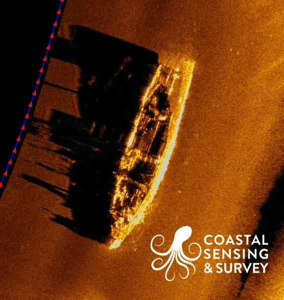
Sidescan sonar is one of the most effective tools for understanding what is actually sitting on the seafloor. It produces high-resolution acoustic imagery that clearly reveals objects, debris fields, infrastructure, habitat features, and subtle changes in bottom texture that traditional depth data alone cannot show. We capture crisp, detailed imagery that supports everything from pipeline and cable inspections to marine construction planning, search missions, and environmental assessments.
Quality sidescan imagery means fewer unknowns, reduced project risk, and stronger confidence in decision making. Sidescan turns the seafloor from an abstract surface into a visible, actionable landscape.