
Insights
The Coastal Sensing Insights section explores the technologies, methods, and applications used to understand underwater environments. These articles provide a closer look at the tools and survey approaches that support hydrographic mapping, marine geophysics, infrastructure inspection, and environmental monitoring.
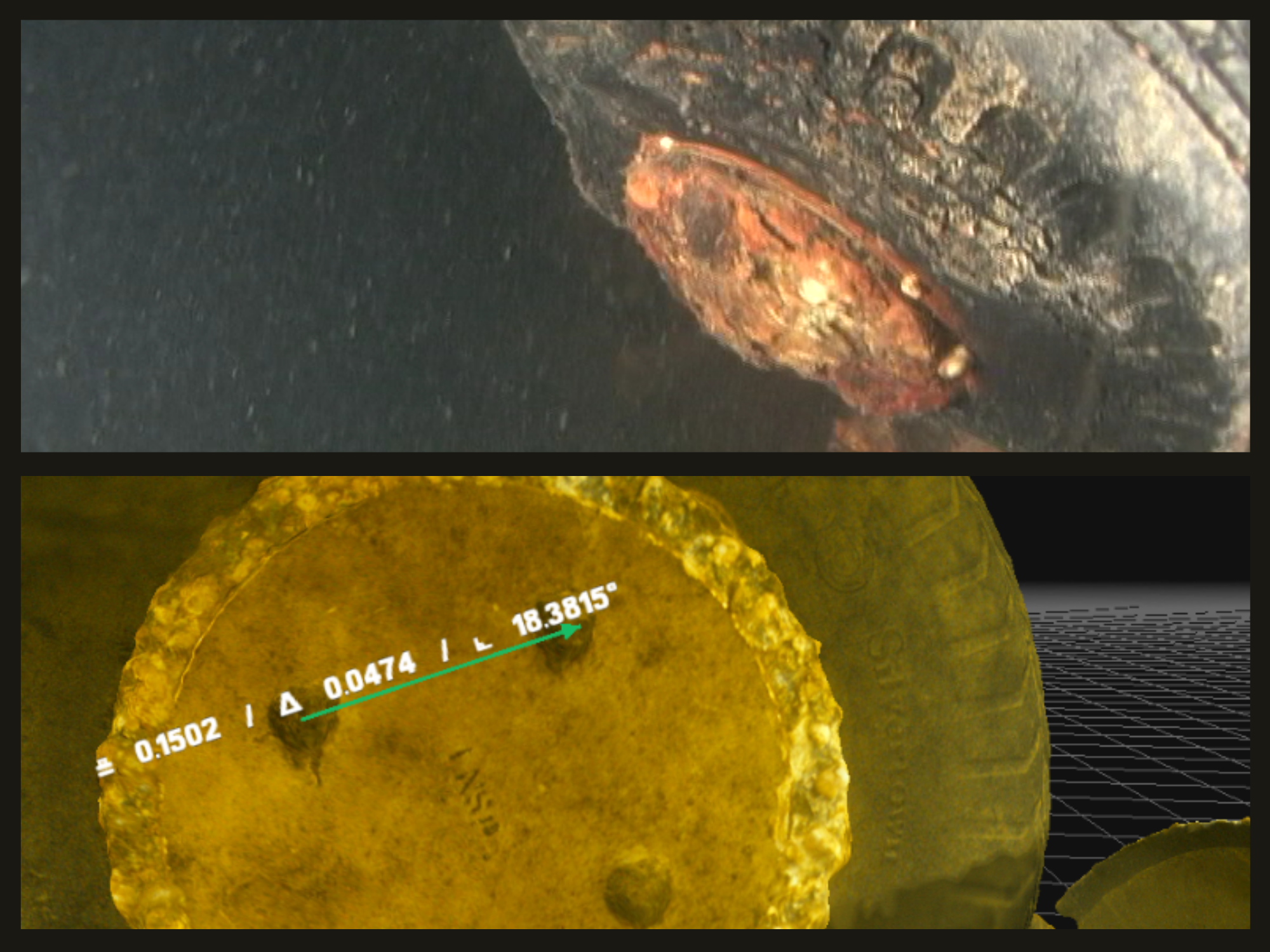
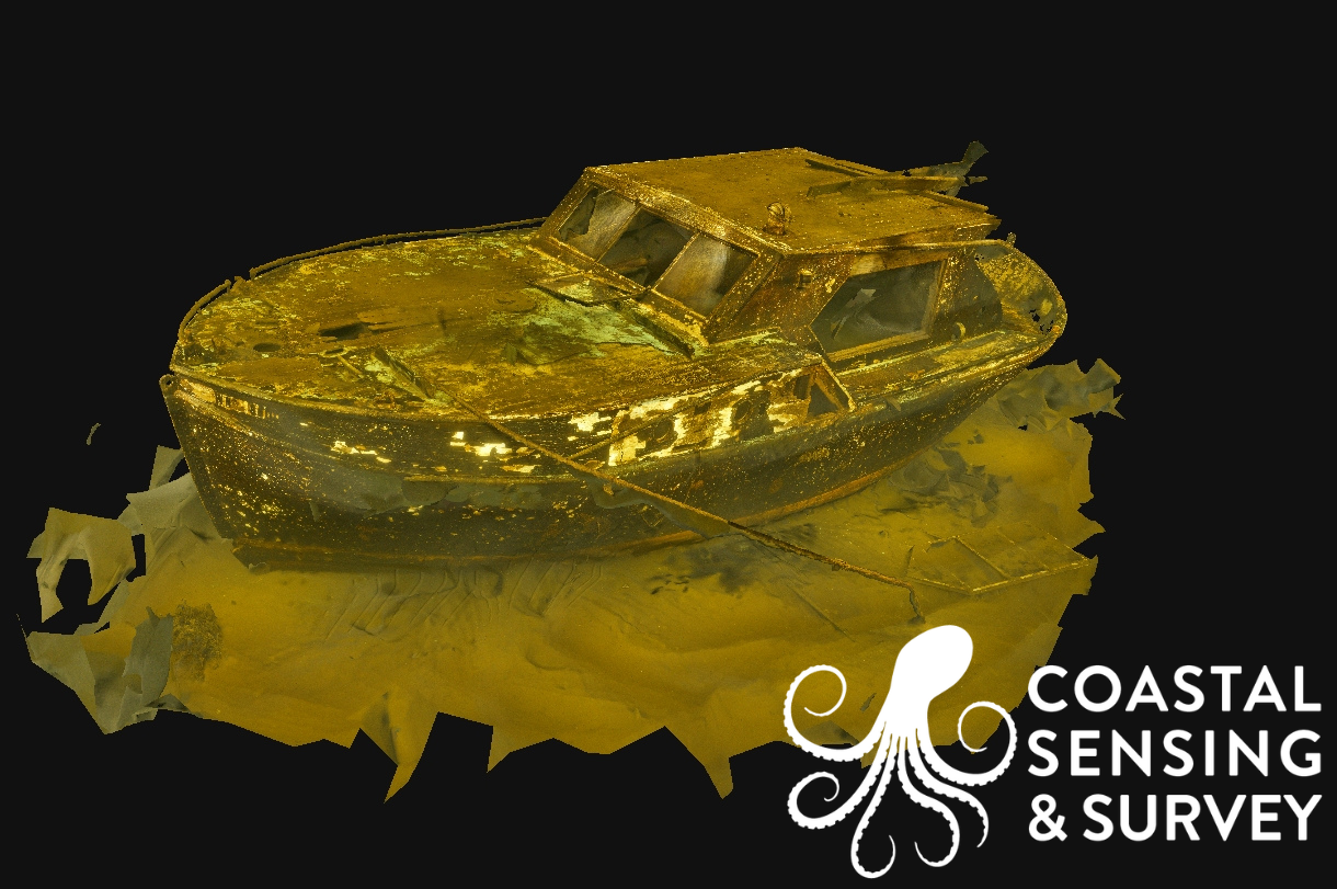
What Is Underwater Photogrammetry and How Is It Used to Document Submerged Environments
Turning underwater imagery into detailed, measurable records of submerged features.
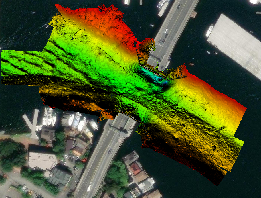
What is Bathymetry and How Is It Used to Map the Shape of the Seafloor
A foundational look at how bathymetric data describes underwater landscapes

Understanding Sidescan Sonar and What It Reveals About the Seafloor
How acoustic imagery adds context, detail, and clarity to seafloor surveys