Multi-sensor Integration
Multi-sensor integration is important because no single system tells the whole story beneath the surface. Combining bathymetry, sidescan, subbottom, magnetometry, backscatter, and photogrammetry creates a layered, cross-validated understanding of site conditions. The ability to collect, process, and interpret these datasets together is still a rare commodity, requiring both technical expertise and thoughtful survey design. When done well, it reduces uncertainty, highlights correlations between surface and subsurface features, and strengthens the defensibility of results. Integrated datasets mean clearer answers, fewer mobilizations, and greater confidence in planning and execution.
Multi-sensor Site Images
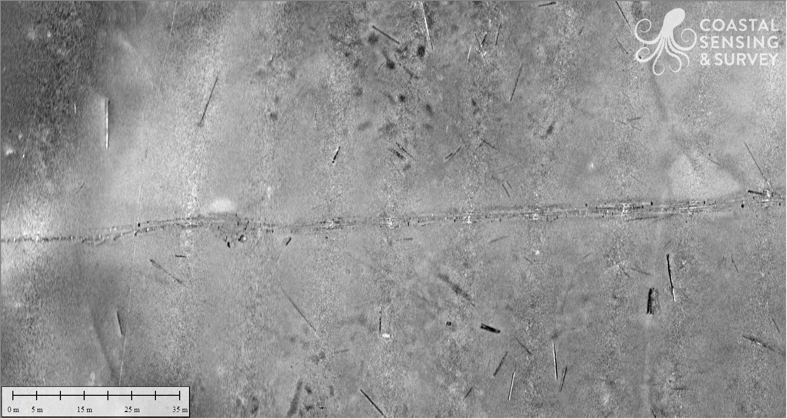
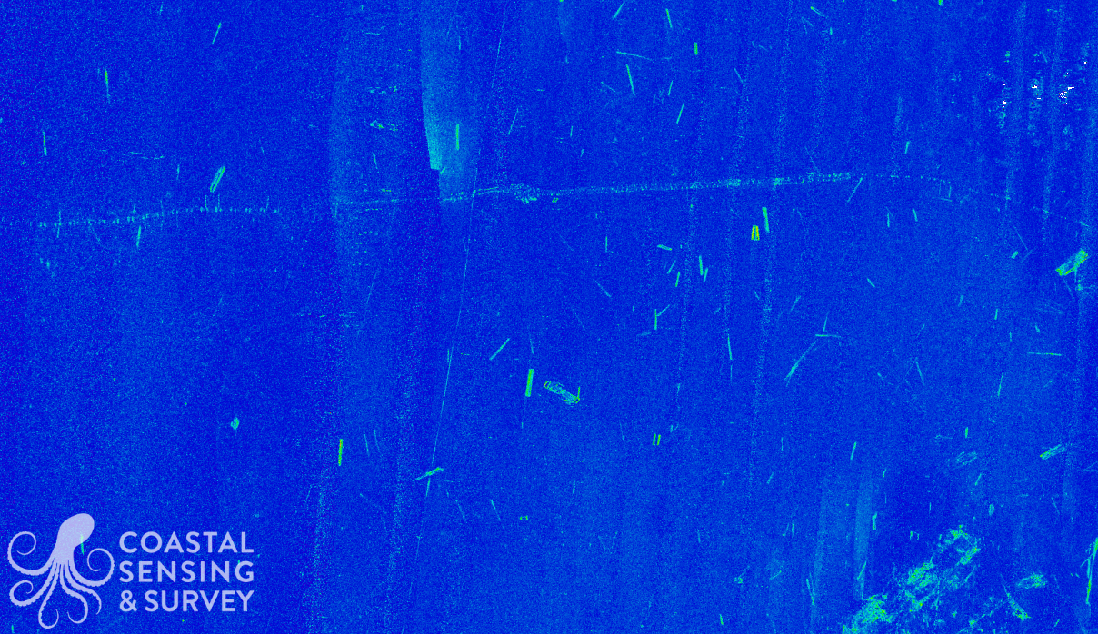
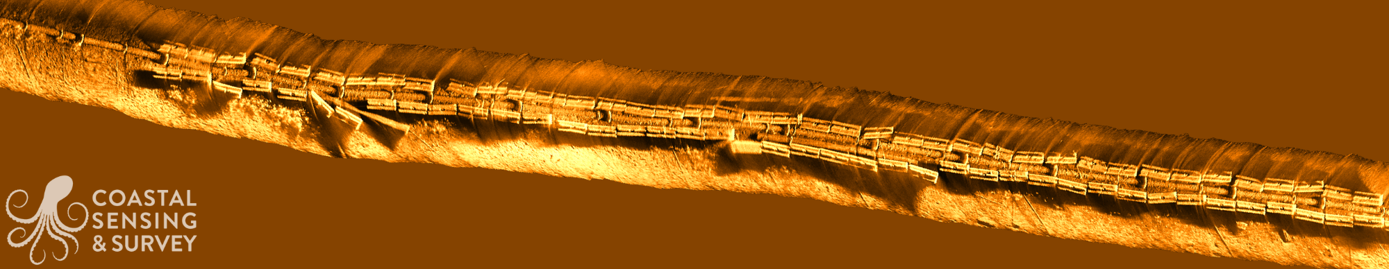
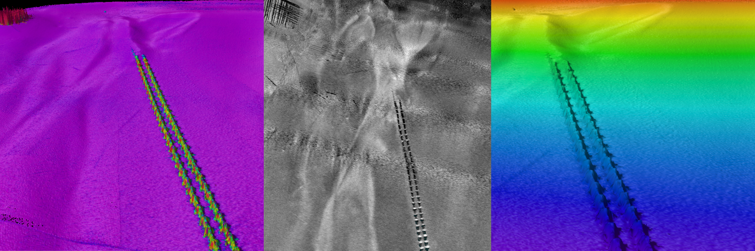
Troy Ohio River
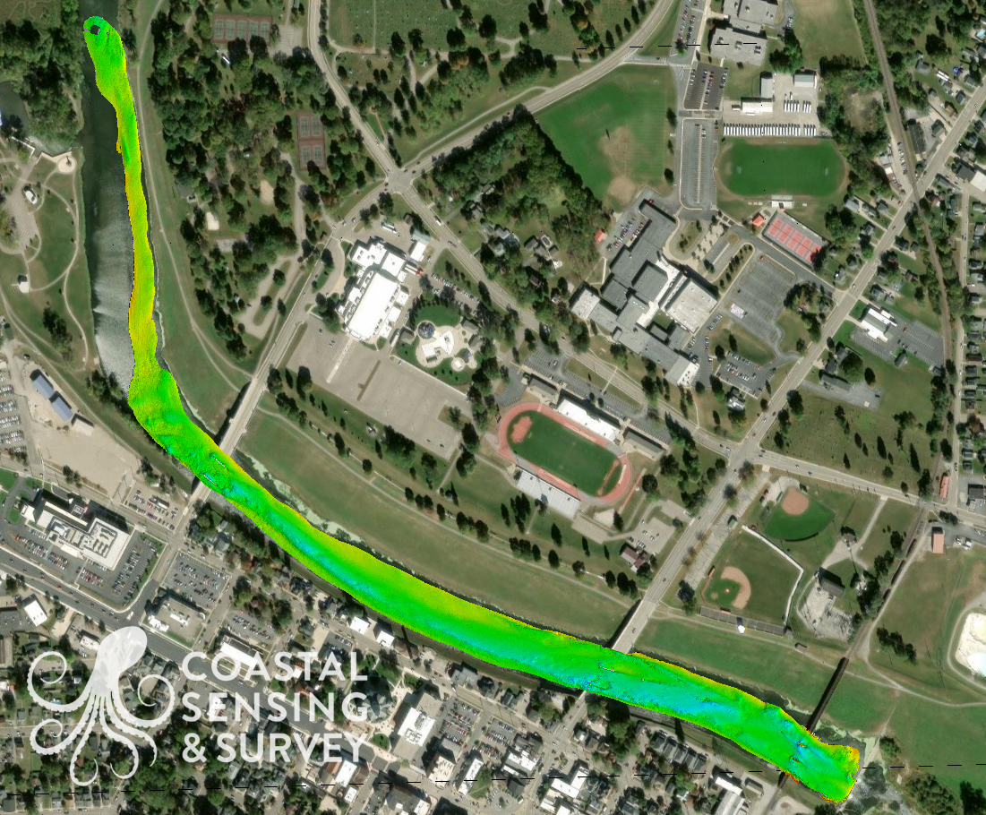
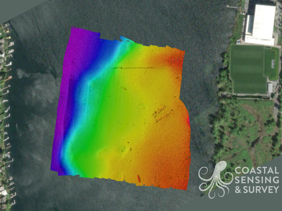
Troy Ohio: Full swath of bathymetry
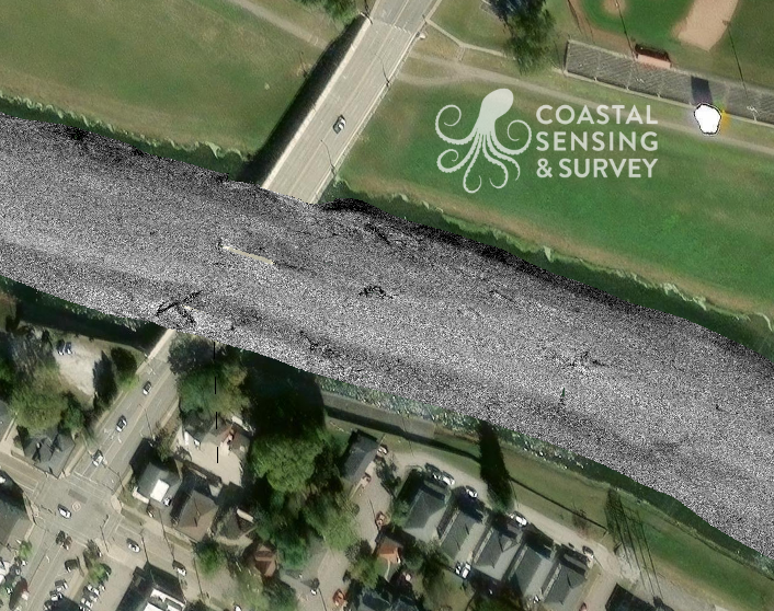
Troy Ohio: Backscatter
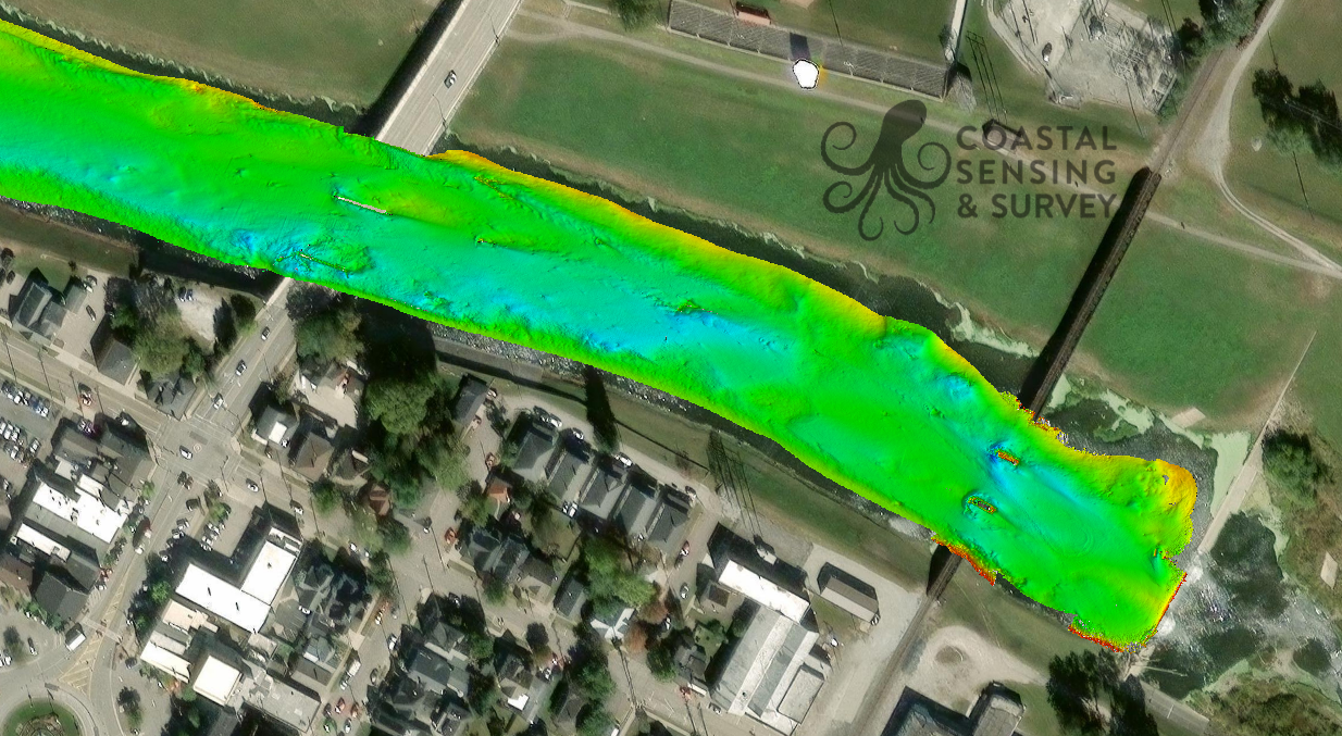
Troy River: Bathymetry
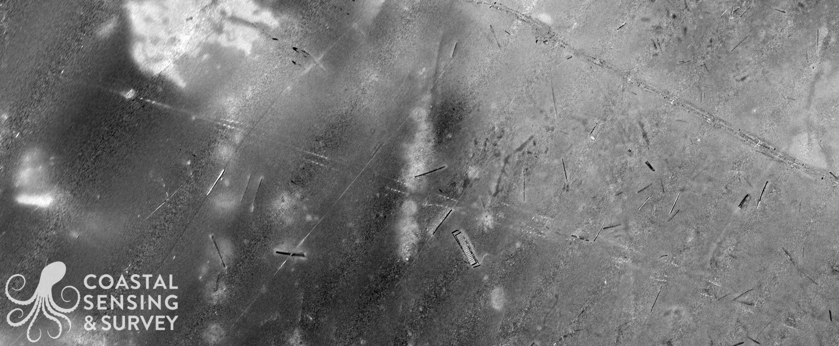
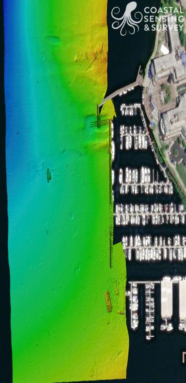
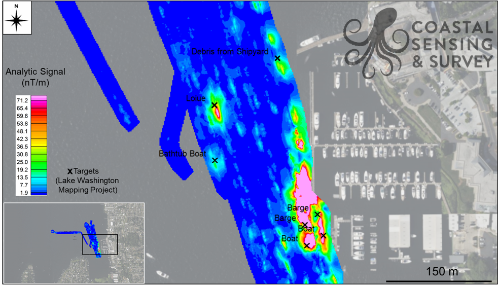
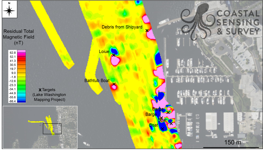
Barbee Mill Superfund Site
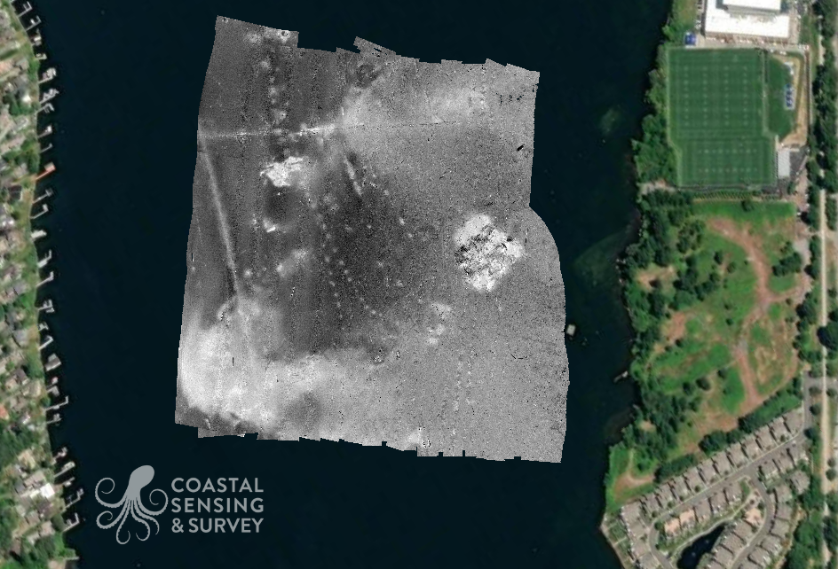
Barbee Mill: Backscatter
Barbee Mill: Bathymetry